A drone’s-eye view of the July 10-11 flood
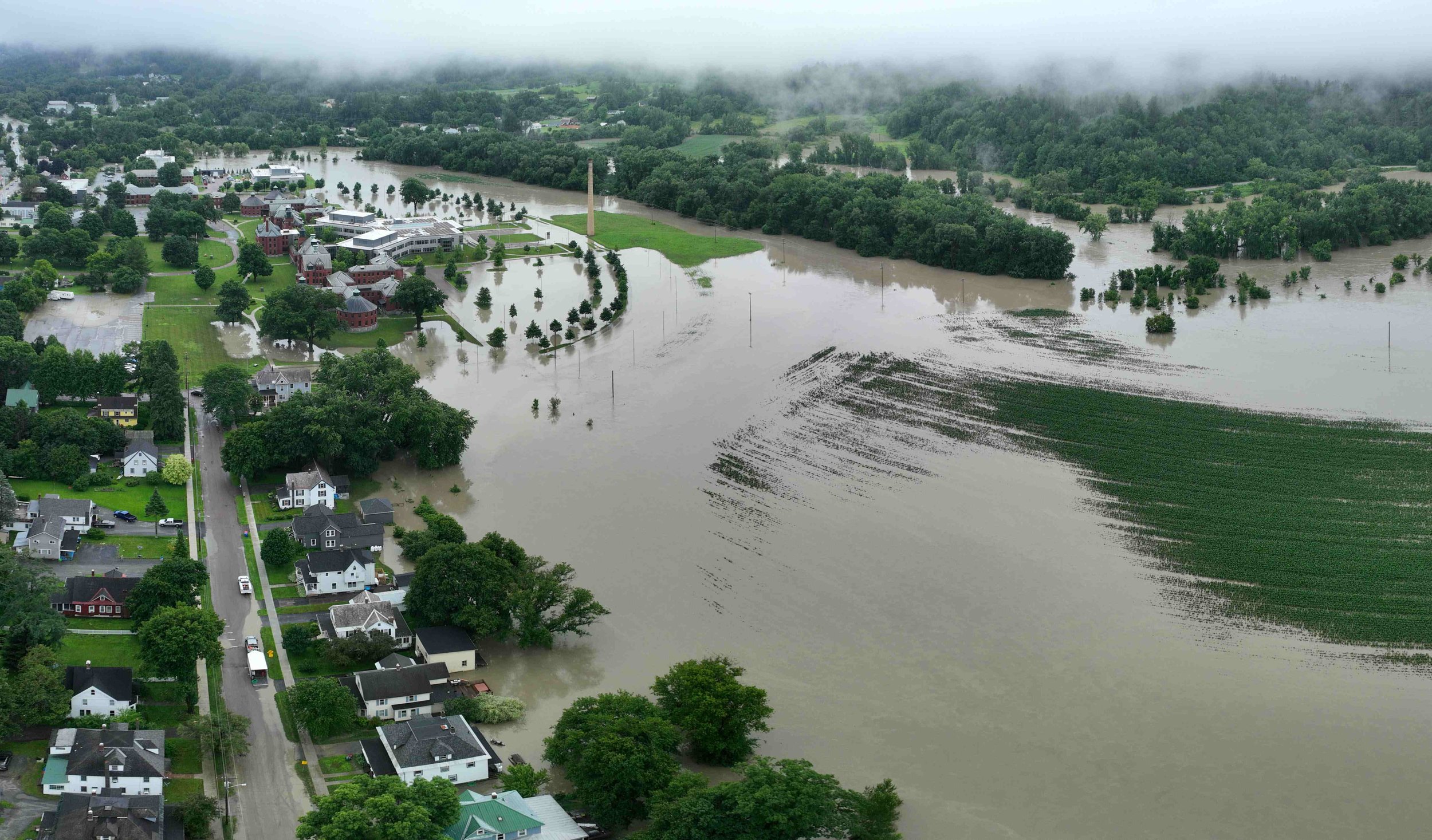
July 27, 2024 | Photos by Gordon MillerEarly morning, July 11, 2024, over Waterbury-Duxbury, the fog hanging over the Winooski River begins to lift. Photo by Gordon Miller
Community conversations have already begun about flood mitigation measures that could lessen the impact of future floods on Waterbury and the surrounding communities.
Ahead of the July 29 Waterbury Select Board meeting to discuss potential projects that could be funded through federal grants, we share a collection of aerial photos captured on the morning of July 11 by photographer Gordon Miller.
The images show the extent of flooding along the Winooski River in Waterbury and Duxbury, the low-lying Randall, Elm, Union street and Armory Drive neighborhoods, the State Office Complex and River Road.
We hope these photos will help inform the discussions as they move ahead.
Monday’s special Select Board meeting is at 7 p.m. upstairs at the Main Street fire station. The public can also join via Zoom with a link on the agenda.
Click to see full images. Scroll over to see captions. Most are written clockwise starting at the bottom.
N. Main, Union, Dac Rowe, Armory-O’Hear, Graves/Thatcher Brook


Below: Randall and Elm streets
Looking up Randall Street, Main Street on the right, cornfield and river to the left. Photo by Gordon Miller


State Complex, Winooski River, River Road Duxbury
Photo by Gordon Miller